Excavation Registration
The Excavation Registration function allows the user to submit registration of excavation activity company/client proposes to undertake on a licence area
Getting Started
- Click on Permit tab
- Click on Excavation Registration link
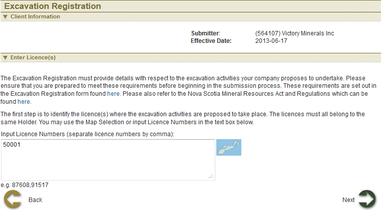
Select Licence
The page provides the user an input field for the applicant information (Submitter is client or agent of client) and select licences for excavation registration. Licences can be selected on map or enter in the input box.

Select licence using Map
 Click
Click  , a window slides into view.
 Click on Select by attribute icon
  to search by licence ID. There are three search layers to search from; Exploration licences, Special Licences, Hydrocarbon Storage-area licences.
 Enter in licence number and click search
 Once licence selection is complete, click
 Click Next
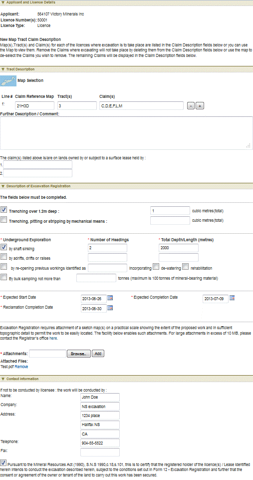
Excavation details
This page shows the licence(s) details. User can identify the specific claims on which drilling will take place and other excavation details.

Select claims using map
 Click
Click  , a window slides into view.
 Click Select feature
  button.
 Use any of the selection Buttons is available to you.

 After selection is complete click
  . The Map viewer will hide automatically. Now the Tract description is amended.
 Click Next button to continue to Summary page.
Review entered Information
This page provides the user with a Summary of the entered information on the previous page. Click Next button to start payment process.
Confirmation Page
This page displays the event confirmation details and the payment summary.
See also